

A collaboration between Parsons and Amazon Web Services has resulted in a new intersection solution that has the potential to reduce urban traffic congestion and save the United States billions of dollars in lost productivity, according to Parsons, an American technology, defense, and infrastructure engineering firm.
Parsons’ Intelligent Intersections Solution employs advanced analytics and algorithms to identify traffic patterns at intersections. Traditionally, such assessments have been conducted by trained personnel who count cars that wait at and move through intersections during specified time frames, making it a time-consuming and expensive process — one that is undertaken about once every five years, according to Andrew Liu, P.E., G.E., M.ASCE, the senior vice president for smart cities at Parsons. With the automated system, however, intersections can now be reprogrammed as frequently as quarterly.
In addition to lessening traffic congestion, Parsons hopes this solution improves air quality and the economics of urban areas. By optimizing the timing of traffic signals, the time cars spend idling at signals could be reduced by up to 40 percent, the company estimates. And if the system were implemented nationwide, it could reduce greenhouse gas emissions an estimated 4.9 million tons annually and boost commuters’ daily productivity by an estimated $27 billion.
Keeping the cost of the system low was a large part of the developers’ focus, according to Liu. The team wanted to make sure that it did not cost more than it typically does to retime signals once every five years. And for that cost, cities will be able to retime their signals 20 times — four times a year for those same five years — instead of just once, he says.
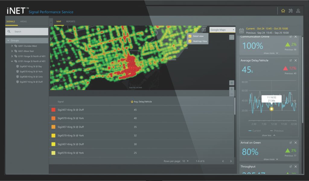
The proprietary technology uses data gathered at intersections by existing sensors and connected vehicles. Every three months, the system generates signal-retiming recommendations based on analyses of this combined data, Liu explains. The recommendations are delivered to a dashboard designed to help a city’s traffic engineers manage their entire traffic network holistically. “This way they can see where the hot spots are, where there are problem areas, and where they can decide to prioritize their resources,” Liu says.
“The beauty of the system is that this is a 100 percent software solution with no need for new hardware,” Liu says. “We also don’t require cities to change their existing traffic management systems. We’re able to connect to all the legacy systems that are in place.” And when new features and software updates are rolled out, the system’s software-as-a-service offering, as such services are called, can update the operating software in the same way that smartphones are updated, according to Liu.
“Once you’re connected, the world is open to you,” Liu says. “Software-as-a-service offering allows our customers to pay for the service as they go, and with that, they get the benefit of the latest technology updates regardless of how long ago they purchased our software,” Liu says. “This is a standard way of doing business for almost every other sector, and the critical infrastructure industry can benefit if both the public and private sectors start thinking about not just technology and innovation but how we innovate the way we do our business as well.”
The product is first being rolled out to the winners of Parsons’ inaugural Smart Cities Challenge, which was conducted last year. More than 50 cities applied to the independently judged competition. The grand prize winner was the Frontier Metropolitan Planning Organization, which serves as the regional transportation planning organization for the Fort Smith, Arkansas, urban area. The second place with distinction went to Austin, Texas, which won a limited trial of the intersection solution.
Parsons will install the systems in these cities and operate them for 12 months as pilot projects. After that, the company will either remove the systems for free or the cities can convert to a subscription model, according to Liu.
In Fort Smith, the technology will be deployed along 21 intersections in a 6.1 mi stretch of the Rogers Avenue corridor and a small section of a parallel corridor, Phoenix Avenue, according to Reese Brewer, the director of the FMPO. Both roads experience frequent and severe flooding because of their locations on the edge of what is known as the nation’s Tornado Alley.
More than 50,000 cars traverse the Rogers Avenue corridor daily, according to Brewer. And while Phoenix Avenue was initially designed as a relief road for Rogers, development has made it ineffective in that role, she says. Adding to the issue of heavy traffic is the recurring concern of red-light running, which “is reaching epidemic proportions in Fort Smith,” Brewer says. Because red-light cameras are prohibited in Arkansas, traffic engineers are limited in their ability to collect data to better understand the phenomenon.
The hope is that the partnership with Parsons will help the city end the dangerous practice of red-light running and “reduce travel times, improve the average daily commute, prevent the loss of life from traffic accidents, and enhance emergency response” by creating “more efficient means to navigate throughout the city,” Brewer says. Enhanced traffic management will enable the city to better address flooding events as well, she says.
In Austin, the solution will be installed in two intersections along the seven-intersection Cameron Road corridor, a major north-south, six-lane arterial road that runs parallel to Interstate 35, according to Jason JonMichael, the assistant director of the Austin Transportation Department. It is a road that experiences high levels of vehicular and pedestrian traffic, he says. “While their technology will work great on all intersections, we can actually pilot the technology in a limited fashion and still gain a lot of very meaningful information on how their system works,” JonMichael says. The department wants to determine how the system affects its overall operations as well, he says.
Revenue-neutral projects within the private sector such as this one are particularly helpful to cities because they allow metropolitan areas to fully test technology in operational environments without any undue safety concerns for normal drivers or pedestrians, JonMichael says.
And with a pilot program “everybody wins,” according to JonMichael. The private sector learns the final details of how their product or service best meets their future clients’ needs, and the city receives a base level of knowledge about how emerging mobility solutions like this one could make a difference in the future.
This article first appeared in the October 2020 issue of Civil Engineering.
